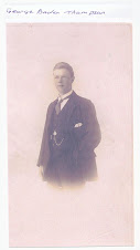
How did William leave Ryton and move to Chirton? These descriptions of the two townships set the scene, and give some clues:
A nineteenth century description of Ryton Parish
"This parish was anciently very extensive, and comprised the whole of Winlaton and Stella parishes, and the newly formed parish of Greenside. Census populations for Ryton were:- in 1801, 432; in 1811, 462; in 1821, 445; in 1831, 590; in 1841, 677…..
"The village of Ryton is charmingly situated upon a steep and richly wooded bank, rising from the river Tyne, seven miles west from Newcastle. A finer situation could hardly be imagined, being, as it is, surrounded by scenery of the most picturesque descriptions. The view to the north-west from the churchyard, up the Tyne valley, is equal to anything in the North. The village in itself is extremely pleasant and interesting, and possesses many fine mansions with well wooded grounds. In the centre of the village stands the picturesque village cross, bearing date 1795.
[From History, Topography and Directory of Durham, Whellan, London, 1894]
A nineteenth century description of Tynemouth Parish
"TYNEMOUTH parish is bounded on the north and west by the parishes of Earsdon, Long Benton, and Wallsend, on the south by the river Tyne, and on the east by the German Ocean. It comprises the townships of Chirton, Cullercoats, Murton or Moortown, North Shields, Preston, Tynemouth, and Whitley, whose united area is 7,222 statute acres. The population in 1801, was l4,345; in l811, 19,042; in l821, 24820; in 1831, 24,778; in 1841, 27,249; and in 1851, it had increased to 30,524 souls.
The surface is generally level, consisting of a strong soil, well suited for the growth of beans and wheat. Coal and ironstone are abundant, and the only magnesian limestone in the country is found in this parish. Three moors, known respectively by the names of Tynemouth Moor, Shire Moor, and Billy Mill Moor, and containing together an area of 1,300 acres, were divided and enclosed, under the authority of acts of parliament, obtained in the reign of George III."
[From History, Topography, and Directory of Northumberland, Whellan, 1855]
The increase in productivity in the coal mining industry at the beginning of the nineteenth century, and the fast developing Parish of Tynemouth within easy reach of Ryton by boat on a tidal river, would have offered many opportunities.
Our William (born 1801) and his siblings John and George married and had families. All their children were christened in Tynemouth parish, so it may have been that the whole family moved down from Ryton in their youth. John was a tailor, and George was a shoemaker; we can assume that William had skills that were in demand, but it was a big jump from his origins as a farm husbandman’s son to becoming a Steamship Owner in the 1851 census, what had been happening in the intervening years to make him so prosperous?
Chapter 3
zondag 18 oktober 2009
Abonneren op:
Reacties posten (Atom)


Geen opmerkingen:
Een reactie posten